
 |
| Map of Gagauzia AU |
Gagauzia is a territory belonging
to Moldova which received a special status in 1995, receiving the right to
establish its own local institutions and body of representatives. The main aim
of this resolution was that of easing the tensions between the Gagauzians, a
group made up of speakers of a Turcik language, closely related to Turkish,
that practice Orthodox Christianity. The Gagauzian Autonomous Unit displays a
series of interesting characteristic, mainly related to its odd shape and
border anomalies, along with a few demographic characteristics that set it
apart from the other regions of Moldova. This paper aims at analyzing the
impact that the geography of the territory has on its current state of economic
and social development, and how much can certain geographical features inhibit
future development. The analysis will take into consideration various factors,
ranging from land forms, border anomalies, agricultural land and infrastructure
to aspects that are more deeply correlated to the territory’s demography:
ethnic diversity, language use and religious groups. Judging from a purely
geographical perspective, Gagauzia is hugely disadvantaged by its discontinuous
landmass, which is can represent a huge obstacle when it comes to uniformly
implementing development policies, it also creates problems when it comes to
transiting between the northern and southern districts. The lack of a seafront,
lack of access to the Danube and the lack of any nearby major urban centers or
important land routes adds up to general lack of socio-economic development
that plagues this region.
Gagauzia can be easily labeled as
one of the oddest odd territorial entities that you can find in Europe, this
comes not only from the numerous border anomalies that this territory has, but
also from an unfortunate combination of geographical factors that greatly
impact its development. It is situated in the southern part of Moldova, in what
is known as “Regiunea de dezolvatare Sud” (Southern Development Region),
bordering the rayons of Cimișlia (north),
Leova (north-west), Cantemir (west), Cahul (south-west), Taraclia (south and
east), Republic of Ukraine (east) and Basarabeasca (north-east). A rayon is the
equivalent of a district, it is an administrative unit that is inherited from
the Soviet Union. The core of Gagauzia is made up of the districts of Comrat
and Ceadîr-Lunga, which are situated to the north, the third district,
Vulcănești, is situated in the south, not very far away from the point in which
Moldova reaches its extremely narrow riverside to the Danube through the port
of Giurgiulești.
 |
| Map of Vulcănești district and the port of Giurgiulești |
Most of the unit’s major
settlements are situated are situates in the proximity of the Ialpug and Lunga
rivers, this being the case of Comrat, the capital, being situated on the right
bank of the Ialpug, When the Gagazians and Bulgarians were colonized in the
region which constitutes today the southern part of Moldova and the southern
half of Ukraine’s Odessa Oblast, all of the settlements were built in the
valley of the Ialpug. The Gagauzians which today inhabit much of Gagauzia’s
territory today, along with the Bulgarians which make up the ethnic majority in
the district of Taraclia, were colonized at the beginning of the XIX century at
the initiative of the Russian imperial authorities, in order to populate the
lands that were deserted by the Nagoy Tatars. The Gagauzians and Bulgarians
were perfect for this job, as both groups were traditionally involved with
agriculture and herding, bothactivities being ideal for the low plains of
southern Moldova. Most the people that were the early colonists came from
Dobrudja, now in Romania, and north-east and central Bulgaria. Their faith is
Eastern Orthodox, making them ideal for the newly annexed territories, making
their assimilation within the Russian society way easier, than, for say that of
the Volga and Pontic Germans.
Going back to our analysis of the
territory, besides the two districts that make up the unit’s core (Comrat and
Ceadîr-Lunga) and the southern
district of Vulcănești, there are other three land masses that are disconnected
from the “mainland”, but all of them are assimilated to one of the three
districts. Between the “northern core” and the southern district of Vulcănești, we find an insular mass of
land which hosts two settlements: Copeac and Chirilovca. This land has an
almost perfectly rectangular shape, being bordered by the district of Taraclia
to the south, west and north, and by the Republic of Ukraine to the east.
The other two lands that are
disconnected from the “mainland” are situated a little bit to the north, one of
them is sandwiched between the territories of the districts of Taraclia and
Cahul, and the last one is situated on the western bank of the Taraclia lake
and it hosts the village of Sarmuza.
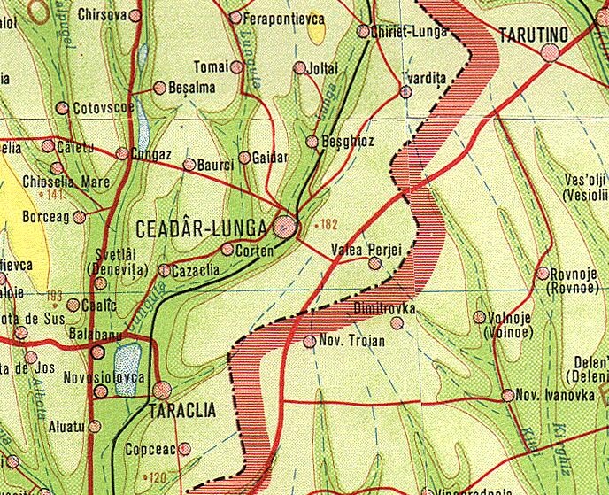 |
| Ceadîr-Lunga district and the Ukrainian border. |
There is a slight difference when
it comes down the physical features of the “northern core” and that of district
of Vulcănești, the north
tends to be a little hillier with more prominent river valleys, being
The territory of the district of
Vulcănești is flatter, having a
south-oriented sloap that gradually decreases in altitude towards the banks of
the Danude. Budjak, or what we know today as the southern half of the Odessa
Oblast, that streches from the Dnister lagoon to the Danube Delta, is generally
characterized by a vegetation made up of small and grassy plants, the climate
is to a certain extent more similar to what we find in Dobrudja (Romania) – hot
summer that are frequently subjected to drought, short transitional seasons,
harsh winters. Gagauzia is situated at the point in which Moldova’s typical continental
climate transitions to a climate that
is still continental but is more prone to aridity and significant temperature
imbalances. Compared to the rest of Moldova’s territory, Gagauzia, along with
the other districts that make up the southern region, receive the biggest
quantity of sunlight, the highest percent is scored by the Danubian port of
Giurgiulești, which is also Moldova’s southernmost point. This constitutes
a huge advantage for the long-term development of agriculture in the region.
The territory of Gagauzia is also
drained by the waters or rivers like Salcia Mică, Salcia Mare and Kagul, the
last one traverses the territory of the district of Vulcănești from north to
south, discharging in the Cahul Lake. The autonomous unit has access to two lakes –
Taraclia (shared with the district of Taraclia) and Cahul (shared with
Ukraine), there is no lake which has its entire surface on the territory of
Gagauzia.
GEOGRAPHIC CHALLENGES
Border anomalies
The fact that the territory of
Gagauzia is so fragmented poses a huge obstacle when it comes to the efficiency
of the territory’s success when it comes to self-governing, but also when it
comes to implementing development policies in a balanced and fair manner
throughout the entire unit. An advantage is constituted by the fact that both
the northern core and the southern
territory share a relative similar physical terrain which makes the needs of
the people from both sides relatively similar but the key factors that could
generate local development differ to a certain degree on the north-south axis.
Vulcănești district is advantaged by its proximity to
the Danubian port of Giurgiulești (Moldova) and Galați (Romania). Galați can
act in the future as a major engine for the development of southern Moldova and
Gagauzia as it can supply this microregion with goods and services that can be
in the price range of its consumers, taking in consideration that the people
from this region live way below the poverty line, a supplier of cheap goods and
services is welcomed. Also, Galați can satisfy the Romanian market anymore due
to the regulations and high standards that are put in place through EU laws and
international regulations. On the other hand, Galați cannot import a very
important element – good practices, as the city is ranked very poorly when it
comes to administrative efficiency. This comes as a big problem for a
relatively poor region, a well developed and highly productive urban center can
accelerate rapid development in the region. The disadvantage is that the
southern district is situated too far away from any influential urban center –
regardless if it is from Moldova, Ukraine or Romania. The Danube also acts as a
natural border, making the access to Romania more difficult, thus greatly
inhibiting commercial and cultural exchanges between the two sides.
The northern core deals with a similar problem, its internal lack of well
developed urban centers, that is topped with the big distance between the unit’s
territory and other major urban centers from Moldova or Ukraine, the closest
major urban settlement being Tighina.
Gagauzia’s border anomalies also
pose a big issue when it comes to the development of infrastructure, this
simply comes as a direct consequence of the fact that the roads and railroads
that transit Gagauzia from the north to the south do not equal a full segment
on its territory. As an effect, roads need to pass through a few other
districts in order to connect various settlements of Gagauzia. Giving the small
size of the unit, it would be hard to develop an exclusively internal network
of roads and railroads, but the border anomalies cause problems when it comes
to perfecting the quality of the roads as a means to accelerate economic
development. It is almost useless if the roads from the northern districts are
in a good shape if the ones from the south are in a deep state of decay. Also,
it is also useless if the national roads are in a good shape on the territories
of the Gagauzian districts and are in a terrible shape in nearby Taraclia and
Cahul districts, this has the potential of inhibit the overall development
potential of the region,
Territory size and urban
centers
The small size of the autonomous unit can represent a huge advantage, this
can surprise some people. If we take a look at the world’s richest nations, we
are looking mainly at micro-states. The tinnier, the easier is to govern a
territory. Also, the small size can be a big disadvantage when it comes to
overcrowding, but this is not the case of Gagauzia, as the population here has a
tendency to shrink rather than growing at an alarming pace. The small size of
the region can represent an advantage when shipping good from one place to the
other, this is also coupled with the relatively flat terrain which makes
transportation and the building of roads relative easy.
The territory of Gagauzia never hosted any significant urban centers,
especially ones that would incorporate heavy industry. Comrat, the capital, and
Ceadîr-Lunga, were centers for the “light industry” or small industry,
hosting industrial activities that were at a little scale, did not necessitate the
construction of working-class neighborhoods, employed a smaller number of
workers than the heavy industry. Also, the urban landscape of the cities from
here make their development into modern urban centers very difficult, this
mainly stands from the fact that they have a very poor infrastructure, a badly
design network of streets, lack of downtown spaces for new commercial and
business centers and a lack of plumbing.
The lack of a seaside. The lack of access to the Danube
Even though the territory is not
extremely far away from the Black Sea coast, it was not blessed with a
seafront, this represents a huge obstacle in the way of its development. Also,
it does not even have access to the tiny Danube riverfront, which is situated
on the territory of Cahul district and is served by the port of Giurgiulești. Waterways can make a huge difference
in economic development, especially commerce.
Not even the internal rivers that flow through Gagauzia don’t
discharge into the Danube, but in the fluvial lagoons. Even so, their small depth
makes navigation impossible.
Traditionally a borderland
If we take a look at the
territory which constitutes modern-day Gagauzia, we will notice that it was a
borderland for most of its history, when it was part of the Principality of
Moldova, Romania or the Russian Empire. This had a huge impact on the overall
development of the region, as empires tend to invest less in the infrastructure
of border provinces as they are subjected to raids and invasions more often.
Also, cultural institutions are always weaker here or nonexistent in many
cases.
Gagauzia's geographic challenge is that balancing out development across its fragmented territory and finding vital links, and engaging in productive collaborations with both the Romanian and Russian-speaking neighboring districts, so that is can facilitate its access to the needed key-strategic development points.
No comments:
Post a Comment